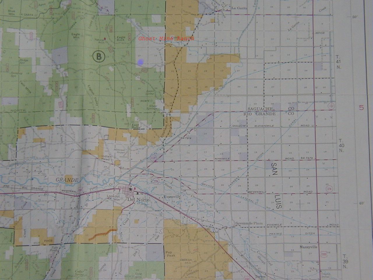
These maps and pictures are of our land, 8 miles due north of Del Norte
in south central Colorado. Del Norte is 31 miles northwest of Alamosa
in the San Luis Valley. In March 2002 we bought 35 acres in Ghost Mine
Ranch, a subdivision inside the Rio Grande National Forest on the west
side of the valley, 45 miles due west of the Great Sand Dunes National
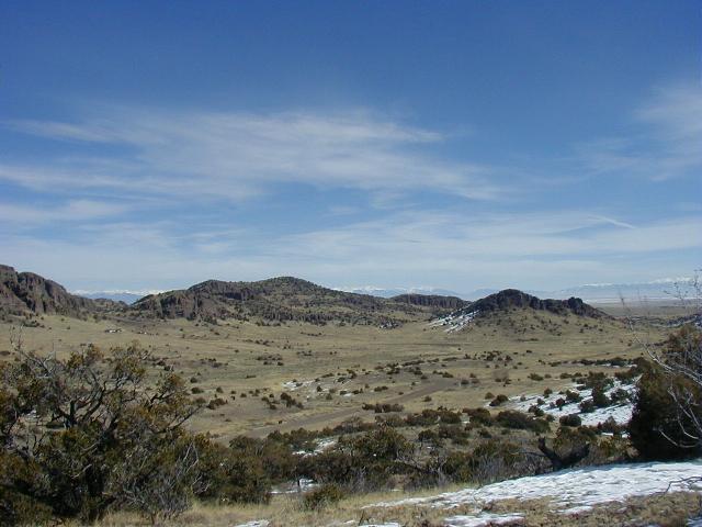
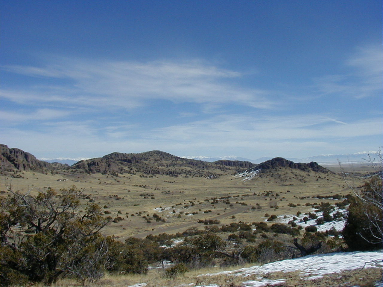
Monument. The rock cliffs surrounding the land are eroded remnants of
the 32 million year old Summer Coon volcano
(see a 1280x1024 ASTER image ). The
land is at 8250 feet above sea level and has dry brush and a few pinyon
trees. It is less than 1/4 mile from the National Forest with many nice
places to walk in the surrounding area. The parcel has well-maintained
dirt roads on the south and west borders. We chose this location to be
close to the high country wilderness of the San Juan mountains, to be
accessible all year long and near towns for retirement, and to be within
a morning's drive of Boulder.
We have a passive solar manufactured house
on this land.
Frank Evans and Susanna Gross
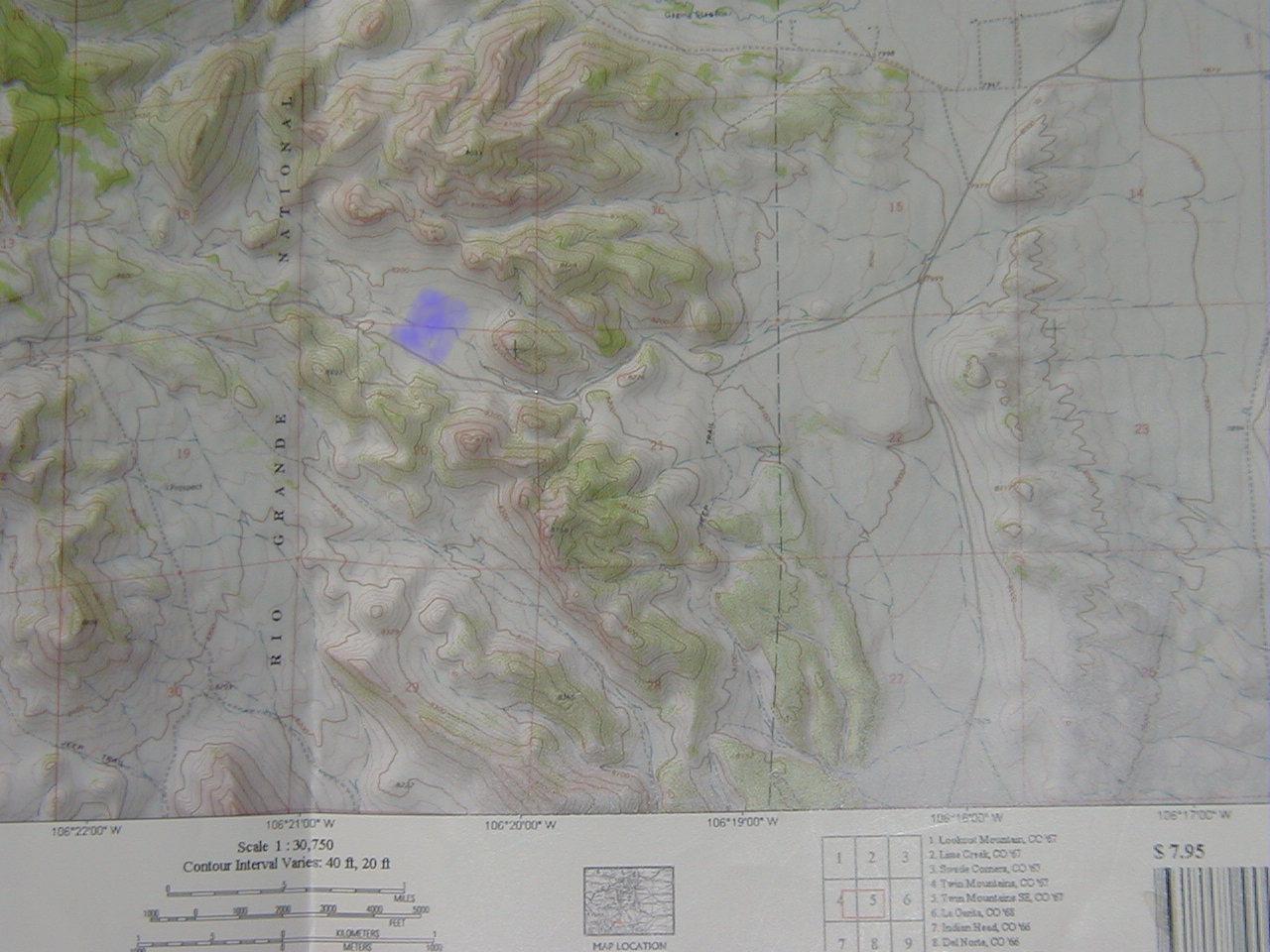
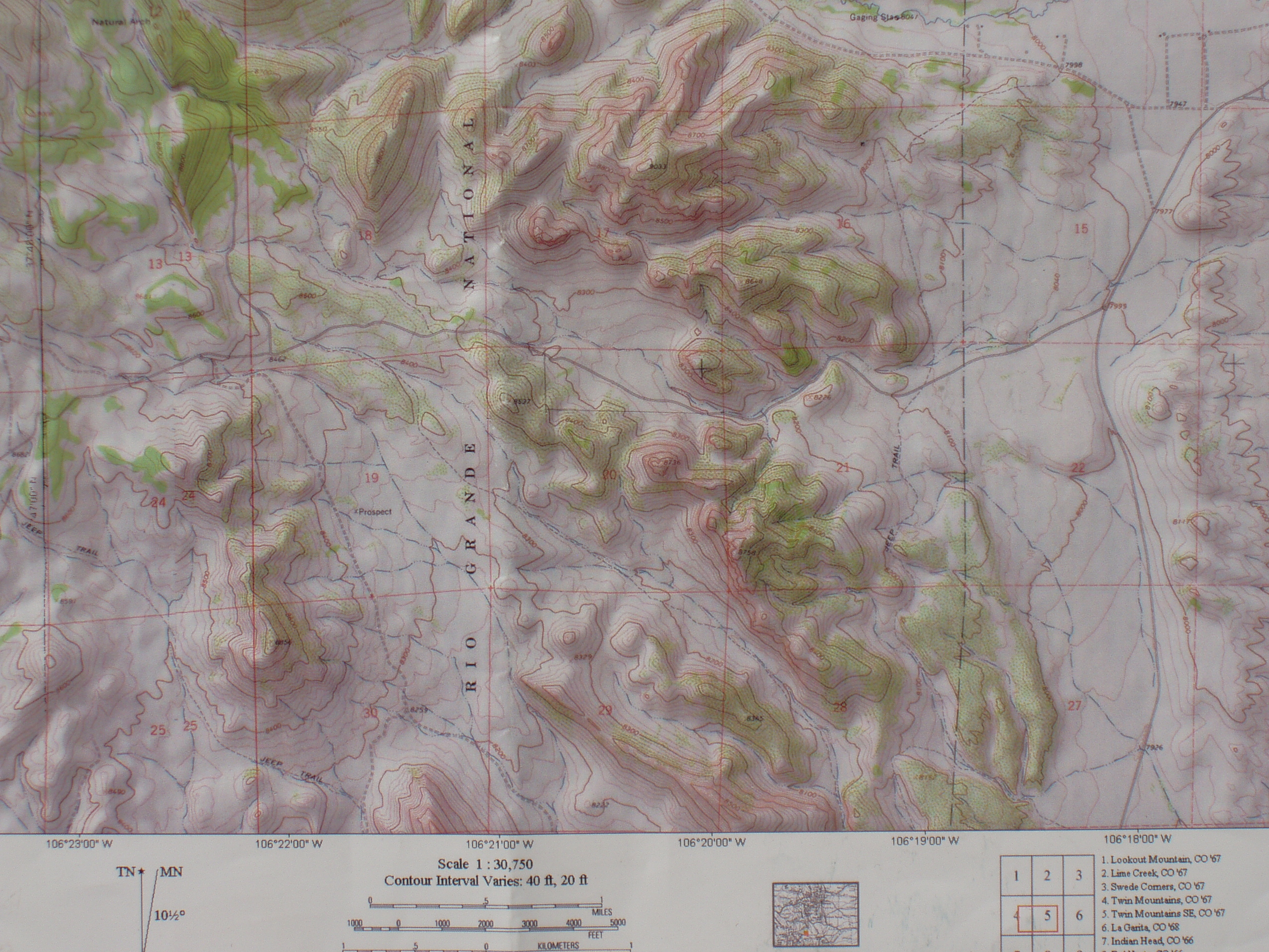
Click on the images for a larger version. The light blue spots on the
maps show where our land is.
Southern Colorado Map
National Forest map
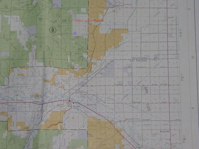
Topographic map
High res topographic map (2.1 MB)
A view east from the Southwest corner.
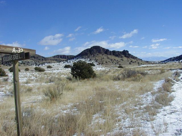
Looking northwest from the interior
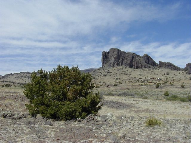
Overlooking the parcel from a hill a half mile southeast.
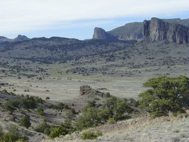
Overlooking the parcel from a hill a half mile southwest.


